Last reviewed October 2026.
Burbank soil, area by area
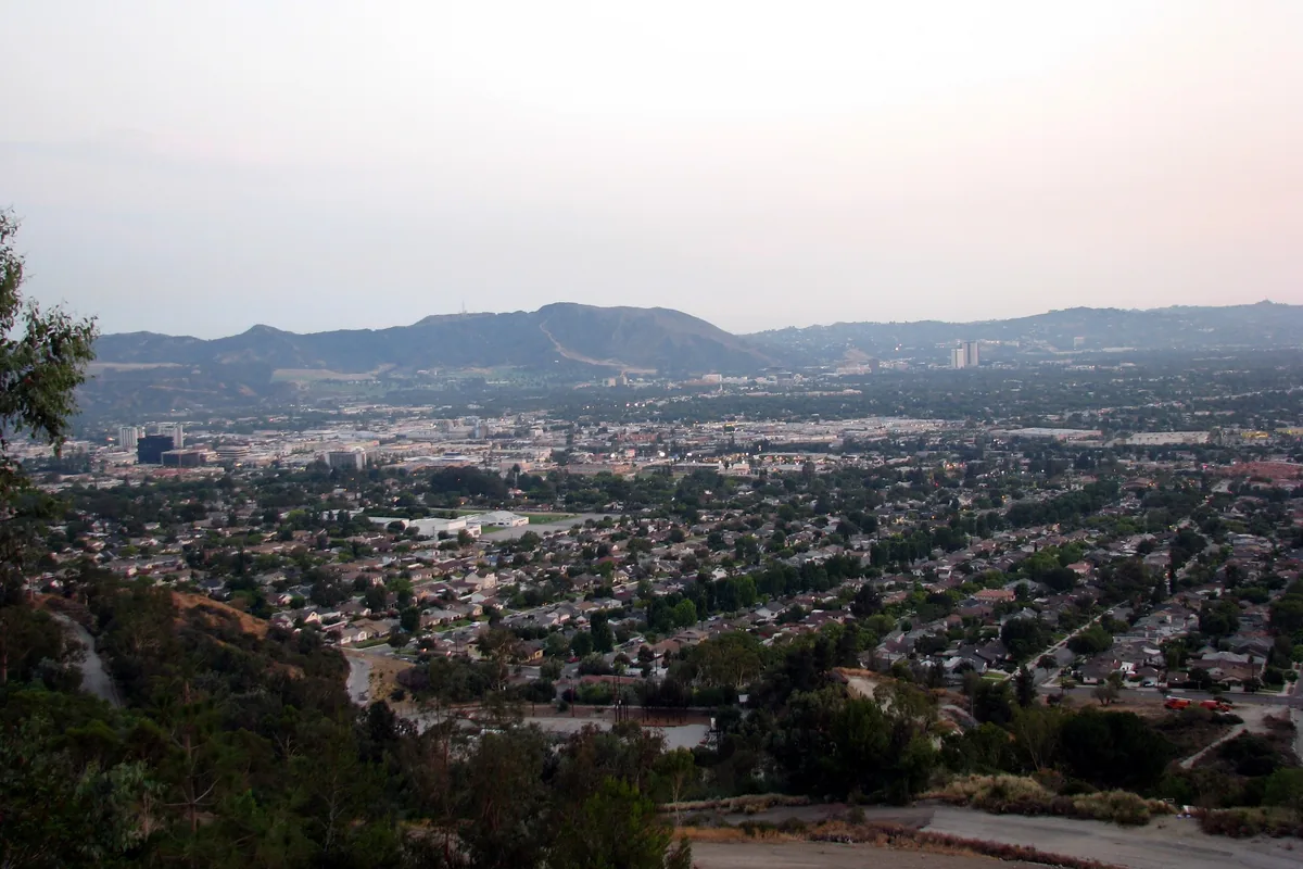
Burbank sits on the eastern San Fernando Valley floor, built on alluvial fans that spread out from the Verdugo Mountains and the canyons above them. That makes most of the city's ground coarse and fast-draining, a different problem from the clay belts in other parts of Los Angeles County. USDA's soil data, the same set behind Web Soil Survey, maps it this way:
| Area | Map unit | Drainage | Shrink-swell |
|---|---|---|---|
| Downtown | Urban land-Palmview-Tujunga, gravelly complex, 2 to 9 percent slopes | Well to somewhat excessively drained | Low |
| Magnolia Park, the Rancho, near the airport | Urban land-Palmview-Tujunga complex, 0 to 5 percent slopes | Well to somewhat excessively drained | Low |
| Hillside streets | Urban land-Typic Xerorthents, coarse-Vista complex, 10 to 35 percent slopes | Thin soil; weathered bedrock from about 26 in | Low |
| Verdugo Mountains above Wildwood and Stough Canyons | Vista-Cieneba complex, 30 to 85 percent slopes | Shallow soil on steep rock | Low |
Swipe sideways to see every column.
USDA NRCS Soil Data Access, queried October 2026. Horizons run sandy loam to loamy sand (sand about 61 to 94 percent, clay about 2 to 13 percent); linear extensibility 0.1 to 1.3 percent. Map units describe areas, not single parcels.
What sandy ground means for a slab
Sand and gravel don't swell and shrink with the seasons the way clay does, so heaving is rarely the cause of a cracked slab in Burbank's flats. The usual culprits are fill that was never compacted (an old pool filled in, a regraded yard), water from a broken line or a downspout washing the base out from under the concrete, and roots. Good practice is the same everywhere: strip the loose material, compact the base in lifts, and send water away from the slab. Slabs and pads are covered on the concrete slabs and pads page.
Faults that can shake Burbank
| Fault | Where, per the Safety Element |
|---|---|
| Verdugo | Inside the city, just south of the Verdugo Mountains; the one active fault in Burbank |
| San Fernando | To the northwest |
| Sierra Madre | Listed among the faults that could shake Burbank |
| Hollywood | To the south |
| Raymond | About 6 miles southeast |
| Newport-Inglewood | About 12.5 miles southwest |
| San Andreas | About 27 miles northwest |
Swipe sideways to see every column.
Burbank2035 General Plan, Chapter 7 Safety (2013). Read October 2026.
Wikipedia's Burbank article (a secondary source) puts the Verdugo Fault about 1.5 miles from the civic center and reports that the 1971 San Fernando earthquake damaged poorly reinforced and unreinforced masonry fences and chimneys in the city, and that the 1994 Northridge earthquake caused $61.8 million in damage in Burbank by the city finance department's count. For concrete, the lesson is the same one the building code already enforces: steel tied into the footing, and concrete foundations designed to an engineer's plan.
Liquefaction and landslides
Liquefaction happens when loose, wet sand loses its strength in strong shaking. Burbank's Safety Element notes that much of the city, especially west of the Golden State Freeway, sits on soil that could liquefy, then adds that groundwater is deeper than 100 feet under most of Burbank. Without water near the surface, the risk stays low for most of the city; some areas along the Ventura Freeway in the southwest are the exception. Exhibit S-4 maps the zone.
Landslides are a hillside issue. The Safety Element flags the steep slopes of the Verdugo Mountains in the north of the city, and notes that mudslides follow storms, especially after long dry spells or fires. That is part of why grading and geology reports come up on hillside lots; see concrete on Burbank hillside lots.
Burbank's flood map
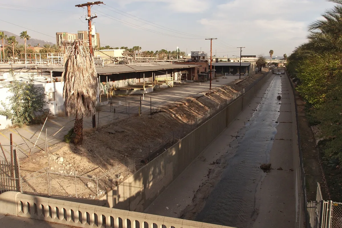
Exhibit S-6 of the Safety Element shows FEMA flood zones in Burbank, drawn from FEMA's 1996 maps. The plan describes flooding as what happens when streams and channels overflow or storm drains are too small for the storm. Concrete channels like the Burbank Western Channel carry runoff through the city. For a single parcel, the current FEMA map is the one that counts, and for new paving the drainage plan matters more than the zone: the permeable driveways and stormwater guide explains when Burbank's stormwater rules apply.
Rain and heat: Burbank weather and fresh concrete
| Measure | Value |
|---|---|
| Yearly precipitation | 13.91 in |
| Wettest months | February 3.95 in, January 2.97 in, March 2.43 in, December 2.02 in |
| July and August rain | 0.01 in each |
| Days at 90 F or hotter | 53.9 a year |
| Days at 100 F or hotter | 7.2 a year |
| August average high | 88.9 F |
Swipe sideways to see every column.
NOAA NCEI 1991 to 2020 normals, station Burbank Glendale Pasadena Airport (USW00023152).
Heat is the bigger concrete problem here than cold. On a 95 degree afternoon, the surface of a fresh slab can dry before the concrete below has set, which leads to surface cracking and a weaker top. Summer pours start early in the morning, and the slab is kept damp or sealed with curing compound right after finishing. Winter pours watch the forecast instead: a heavy February storm on a slab that hasn't set can mar the finish.
Looking up your own lot
- Soil: search the address on USDA Web Soil Survey and draw a box around the lot
- Faults, liquefaction, landslides and flood zones: the Safety Element exhibits S-4, S-5 and S-6
- Earlier soils reports: ask Building and Safety (818-238-5220) about the address file
- Hillside lots: check whether grading or a geology report applies before design
The ground matters most for retaining walls and foundations. For driveways, patios and everything else, see the concrete contractor in Burbank page.